
Firm’s Experience: GIS
A geographic information system (GIS) lets us visualize, query, analyze, and interpret data to understand relationships, patterns, and trends. GIS is one of the most popular interfaces where geo data is stored, manipulated, analyzed, visualized and applied in a multiplicity of professions ranging from environment management, disaster management, urban planning, land management, crime analysis, etc. The knowledge of GIS greatly enhances the productivity and utility of surveyors, engineers, environmentalist, spatial planners, decision makers, etc and takes them to a new height. GIS as a decision support system helps to make informed and optimal decisions based on spatial logic and real data. Some of the benefits of having a GIS system are:
The following are the projects where a GIS system was developed for planning, inventory and understanding the existing conditions of farm roads and irrigation canals in the country.
I. Development of Digital Base Map from Satellite Imagery for Haa Valley.
Major activities carried out are:
- Input used WorldView 3 (30 cm) Stereo Imagery
- GCP observation
- Control densification for terrestrial surveys
- Image restitution and bias removal in RPCs
- Photogrammetric processing
- DEM generation and editing
- Ortho rectification and Ortho-Mosaicking
- Integration of terrestrial and photogrammetric data
- Stereo digitizing of Building features
- Overlay of Cadastral Data on Ortho Imagery
- Topographic Mapping at scale 1:1000 and 1 m contour interval
- Area Surveyed and Mapped: 35 sq. km
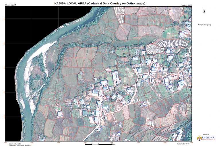
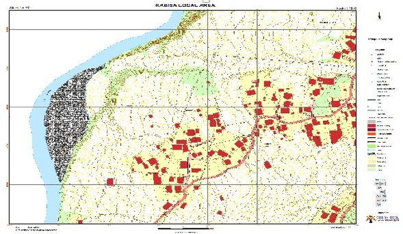
II. Topographical Survey, Mapping and Geodatabase development for Kabisa Local Area Plan under Kawang gewog, Thimphu
Major activities carried out are:
- Input used GeoEye 1 Stereo Imagery
- GCP observation
- Control densification for terrestrial surveys
- Image restitution and bias removal in RPCs
- Photogrammetric processing
- DEM generation and editing
- Ortho rectification and Ortho-Mosaicking
- Integration of terrestrial and photogrammetric data
- Stereo digitizing of Building features
- Overlay of Cadastral Data on Ortho Imagery
- Topographic Mapping at scale 1:1000 and 1 m contour interval
- Area Surveyed and Mapped: 2 sq. km
Client: Thimphu Dzongkhag Administration.
III. National Irrigation Database & Canal Alignment Mapping, Bhutan.
Major activities carried out are:
- Survey and Mapping of Irrigation Canal with GPS
- Identifying and mapping of Command Area using satellite imagery
- Geo database development for Irrigation Canal Network
- Client: Department of Agriculture, MoAF, Thimphu, Bhutan
- Duration 3.5 Months
- Year 2013
IV. Validation and Digital Mapping of Farm Roads, Bhutan.
Major activities carried out are:
- Survey and Mapping of Farm Roads with GPS
- Geo database development for Farm Road Network
- Client: Department of Agriculture, MoAF, Thimphu, Bhutan
- Duration 3 Months
- Year 2012