Firm’s Experience: Photogrammetry and Remote Sensing
Since our firm went into operation in 2011, the following are some of the photogrammetric projects that we have taken up for various clients in the recent past. The projects undertaken so far are:
I. Topographical Survey, Mapping and Geodatabase development for Kabisa Local Area Plan under Kawang gewog, Thimphu
Major activities carried out are:
Input used GeoEye 1 Stereo Imagery
GCP observation
Control densification for terrestrial surveys
Image restitution and bias removal in RPCs
Photogrammetric processing
DEM generation and editing
Ortho rectification and Ortho-Mosaicking
Integration of terrestrial and photogrammetric data
Stereo digitizing of Building features
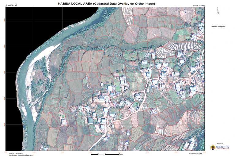
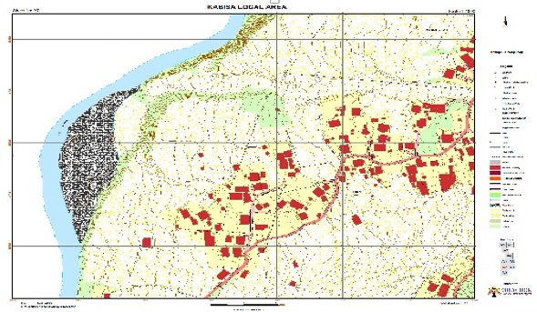
Overlay of Cadastral Data on Ortho Imagery
Topographic Mapping at scale 1:1000 and 1 m contour interval
Area Surveyed and Mapped: 2 sq. km9
Client: Thimphu Dzongkhag Administration. Completed and delivered
Fig.1: Cadastral Data Overlay on Ortho Image
Fig. 2: Topographic Map
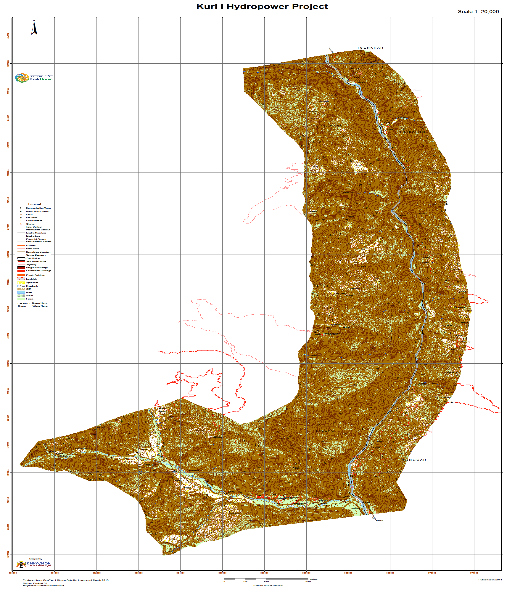
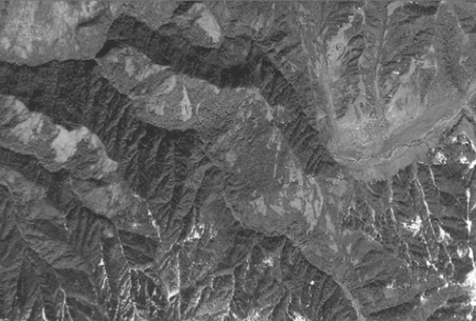
II. Topographic Survey and Mapping of Rotpashong Hydropower Project, Monggar.
Major activities carried out are:
Input Imagery is GeoEye 1 Stereo Imagery
GCP observation
Image restitution and bias removal in RPCs
Photogrammetric processing
DEM generation and editing
Ortho rectification and Ortho-Mosaicking
Integration of terrestrial and photogrammetric data
Stereo digitizing of Building features
Topographic Mapping at scale 1:5000 and 5 m contour interval
Area Surveyed and Mapped: 65 sq km
Client: DGPC, Thimphu, Bhutan. Completed and delivered.
Topographic Layout map of the project Area
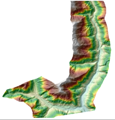
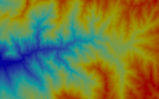
Digital Elevation (5m x 5m)
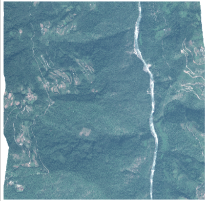
Ortho Image
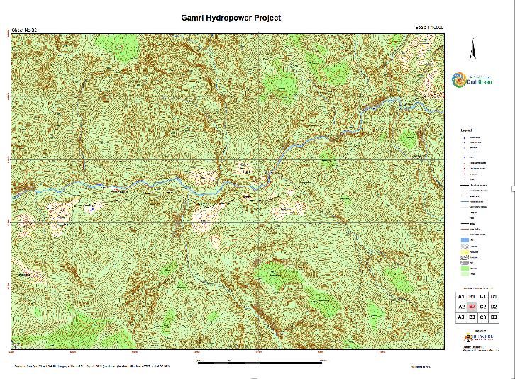
III. Topographic Survey and Mapping of Gamri Hydropower Project, Trashigang
Major activities carried out are:
Input Imagery is WorldView 1 Stereo Imagery
GCP observation
Image restitution and bias removal in RPCs
Photogrammetric processing
DEM generation and editing
Ortho rectification and Ortho-Mosaicking
Integration of terrestrial and photogrammetric data
Stereo digitizing of Building features
Topographic Mapping at scale 1:10000 and 10 m contour interval
Digital Elevation Model (10mx10m)
Ortho Image
Topographic Map 1:10000 & 10 m CI
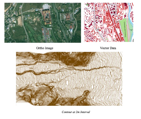
IV. Topographic Survey and Mapping of Thimphu Thromde, Thimphu.
Major activities carried out are:
Input Imagery GeoEye 1 Stereo Imagery
GCP observation
Image restitution and bias removal in RPCs
Photogrammetric processing
DEM generation and editing
Ortho rectification and Ortho-Mosaicking
7. Integration of terrestrial and photogrammetric data
8. Stereo digitizing of Building features
9. Topographic Mapping at scale 1:5000 and 2 m contour interval
10. Area Surveyed and Mapped: 26 sq km
11. Client: Thimphu Thromde, Thimphu, Bhutan. Completed and delivered
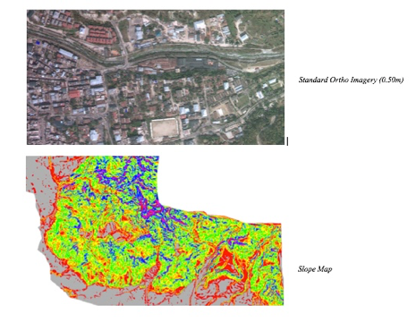
V. Topographic Survey and Mapping of Phuentsholing Thromde, Phuentsholing
Major activities carried out are:
Input Imagery is GeoEye 1 Stereo Imagery
GCP observation
Image restitution and bias removal in RPCs
Photogrammetric processing
DEM generation and editing
Ortho rectification and Ortho-Mosaicking
3. Integration of terrestrial and photogrammetric data
4. Stereo digitizing of Building features
5. Topographic Mapping at scale 1:5000 and 2 m contour interval
6. Area Surveyed and Mapped: 26 sq km
7. Client: Phuentsholing Thromde, Phuentsholing, Bhutan. Completed and delivered